Canoeing the Connecticut
An Account of a 410-mile-long canoe-camping trip from the Source of the Connecticut River in New Hampshire, on the Canadian border, to the Sea at Long Island Sound
This series of articles was written and published in The Hartford Courant in 1991. I wrote these dispatches every two or three days from the banks of the river. I include them on this site because I am still asked occasionally if the articles can be accessed online. Keep in mind, laptop computers were still in their infancy at the time, and cell service was iffy or non-existent in much of the northern Connecticut River valley. The series is essentially as originally written, though I have tightened it ever so slightly, added or deleted a word here and there, added brief explanatory information where it seemed appropriate.
June 2, 1991
At Pittsburg, New Hampshire
It had rained lightly for an hour, and now the sun was out. Humid. The trail was muddy and steamy, steeper than I remembered. We were sweating when we reached the little pond deep in the woods.
Marty Hewson, an inspector at the U.S. Customs House at the Canadian border, understood right away why we wanted permission to park behind the customs office and hike up a rocky hillside to see a pond not much bigger than a football field, though its name, Fourth Connecticut Lake, suggests it is something much bigger.
The pond is about 300 yards south of the Canadian border. You hike a mile or so along the international boundary, then turn left through dense forest. Fourth Lake is the beginning of the Connecticut River, New England's largest. It is fed by rivulets that trickle off the hillside, beginning a 410-mile southerly journey to Long Island Sound.
“About 200 went in last year,” Hewson said. “We’re getting more and more. A lot of them are from Connecticut or Massachusetts. They want to see the beginning – ‘Where’s it start?’ they ask.”
I told Hewson that I wanted to visit the source of the Connecticut, as I did once eight years ago, because this time I was about to canoe the river all the way to the Sound over the course of four or five weeks.
Not many people canoe the entire river at one time – my guess is a few at most each year, if that - but those who have almost always walk in to Fourth Lake, to the very source.
I reached down and touched Fourth Lake about 2:45 p.m. Wednesday. I was standing on a mat of sphagnum, and the black flies zeroed in on every square inch of exposed flesh. A forest of spruce and fir surrounded the pond. It was quiet.
Michael McAndrews, a photographer for The Hartford Courant, is with me for parts of the trip. We slathered ourselves with insect repellent, slapping bugs even as we did. We walked around the bog to find the little stream that spills from it.
The Connecticut River is a mile wide at its mouth, but as it leaves Fourth Lake, it is maybe 4 feet wide and, on this day, not much more than 6 inches deep in places, overhung with shrubs and trees.
I can say I jumped across the Connecticut River.
We worked our way back out, stopping to report to Hewitt, as we were supposed to do, and to tell him that the voyage had begun.
Why? Why spend a month pushing a canoe down a river, dragging it around 17 dams, living out of whatever will fit in a 16-foot canoe?
People do ask.
Some of my colleagues in The Courant newsroom - I write about nature for the Courant - have the idea that I am doing this because it is a wonderful way to get out of the office and into the sunshine for the month of June. They have suggested that after 20 years in journalism, I have become highly skilled at finding ways to get outdoors on assignment. Sure, there is a modicum of truth in that, but I genuinely see this opportunity as an exciting way to present the river in its entirely to readers.
I see the Connecticut as a living seam through New England, a natural presence that binds us, draws us to its waters. The idea of paddling the whole river and writing about it has been a compelling desire for years, very much in keeping with my belief that journalism is an important vehicle to help bring about an understanding and appreciation of nature, which is a fundamental first step in preserving a healthy environment.
Over the centuries, the Connecticut has been navigated in many ways. The Indians cruised the river in canoes, gathering furs to trade with the early settlers. In the 1800s, the lower Connecticut River was a hub of steamboat traffic. Now that section of the river is thick with pleasure boats and the barges that carry the oil we are so dependent upon.
Canoeing it top to bottom, between New Hampshire and Vermont, then through Massachusetts and Connecticut, ought to yield some sense of the valley in these closing years of the 20th Century. To paddle it all at once, in one big dose that will capture it whole, should let the river’s personality disclose itself.
The river begins as a chain of lakes - Fourth, Third, Second, and First, so named for their increasing remoteness from the village of Pittsburg.
From Fourth Lake, the infant river tumbles down a hillside, cascades over a waterfall and pours out into Third Lake, a two-mile long patch of blue on a sunny morning. Brook trout feeding on insects dimpled the surface of the lake. A fishing lure tossed amid the dimples produced several trout in minutes. We photographed one, and let them all go.
The only development of any kind on Third Lake is a boat launch. From its waters, the view in every direction is mountains, a textured mass of deep green spikes of spruce and fir amid the softer shapes and greens of birches. A pair of loons and a pair of mergansers fished the lake. What I assumed was a family; husband, wife and son, trolled the lake for trout. A man and his son, I again assumed, fished together from shore. And us. That was it.
We were camped at Deer Mountain Campground, just below Third Lake, where the river is about 8 feet wide. What began as a sunny day became cloudy as we reached Second Lake later in the day.
Second Lake is a bigger lake, about five miles long. Amid the thick clouds, its surface was gray, the mountains purplish. It began to rain as we reached the end of the lake. We would have to put up a tarp to cover our eating area at camp. We were in for a soggy night, already.
Aside from the newsroom, people who’ve heard about this trip have often reacted one of two ways. They either say, “What a great idea,” or, they ask, “What does your family think?”
My wife, Susan, is best described on this question as a good sport. She is not one of the “great idea” group, though she has nothing against canoeing or the outdoors and can enjoy a day on a river herself. She thinks that it’s nice I can do this; and she figures she’ll somehow survive a month juggling a career and the children, Allison, 8, and Scott, 4, alone.
Scott does not have a good handle on the scope of this expedition. His last question before I left was, “Are you going to have lunch on your trip?”
My parents seem intrigued, and a bit apprehensive. “How do you know when you’re getting near a dam?” my father, Sherman, asked. My mother – “That’s Marjorie K. Grant, of Plainville” she reminded me in her mock-serious way - wanted to know how I would get a haircut when I need one.
People have a lot of other questions, too. They’ve asked how I will get groceries, what I will eat, how far I will paddle each day.
With the exception of Fourth Lake and a few miles of unnavigable water, I am canoeing the entire thing. My plan is to paddle an average of 14 miles a day, some days more, some days less.
The Courant has outfitted us with the latest in equipment, to supplement the paddles and lanterns and tents and other things that help fill my basement and garage. Michael and I each have a two-person tent, which, if you know about tent sizes, actually means each is comfortable for one person.
An orange plastic rucksack is filled with food and cooking equipment. I like to cook and plan to make things like biscuits and simple stews, pastas with a quick sauce, as I travel.
We have a roll-up table, about the size of a card table, and much too much else. To help move all this stuff around dams and obstacles, we’ve brought a four-pound pair of wheels to move the canoe. It is another four pounds to push down the river, but that’s the way it is with canoe trips.
Should I have the time, I have along a couple of paperbacks, a biography of Thomas Jefferson and essays by Wendell Berry. Like I said, I brought a lot of stuff.
Then there is the matter of the electronic equipment, a bagful of battery-powered devices that illustrate the dichotomy between my means of travel and my means of communication.
I will write articles about three times a week as I work my way down river.
To do so, I have along a laptop computer that will work on batteries or electricity. To file stories, I couple my computer to a telephone - maybe a pay telephone one day, a farmhouse phone another - and press a few keys. The story should appear seconds later in The Courant computer. Should. This technology is not glitch-free.
For part of my trip I’ll have a battery-powered cellular phone, which actually would allow me to make calls and send stories from the canoe. Finding cell service, however, likely will be issue.
The trip should take about a month or five weeks, I figure. Many days, I’ll be alone. I don’t know what it will be like to canoe alone for many days. Maybe I’ll be lonely. I already miss the family. Maybe I’ll be exhausted at times. Maybe I won’t want to work in an office again.
In my most optimistic moments, I foresee a trip in which the sun shines and getting from one place to another is pleasantly physical. There’s time to make a delicious supper or dine in a nice restaurant once in a while. Writing in a tent or on a picnic table is rewarding.
In my most pessimistic moments, I fear most that I will become exhausted. I am 44 years old, and I worry that canoeing alone that long will wear me out, that I will have to quit, very publicly embarrassing myself.
I worry that it will be a rainy cold month and that I will be more unhappy than happy. I think about the inevitable days when the wind will come from the South in my face and pushing the canoe forward will be almost painful. I worry that my family will need me and I won’t be there.
Pittsburg is a long way from the well-to-do Connecticut communities of Old Lyme and Old Saybrook at the mouth of the river. It is a town of a few hundred people living in several hundred square miles of forest, lakes and streams, a town the size of Hartford County.
There is a general store where you can get most things you’d need. But things like touch-tone telephones have not reached Pittsburg yet. Logging the forest is the industry here.
In Pittsburg, there is a North Woods version of a Sunday drive. It is to drive slowly along Route 3, the only paved road of any size, at dusk. You can drive all day on Route 3 in Pittsburg and you’ll see few cars. But at dusk, in summer, you’ll see cars inch along, people peering out the windows, sometimes stopping right in the middle of the road.
They are moose-watching. If you drive Route 3 in Pittsburg at dusk, you might see a half dozen of the big animals, feeding here and there in the wet lowland spots. Some of them amble off in their ungainly way if a car slows. Others just stare back at the cameras.
One evening before the trip began we passed six moose, a deer, two rabbits and a porcupine in about 10 miles on Route 3
At our campsite, the rain intensified. We fumbled with a tarp, finally managing somehow to cover our table enough to prepare dinner and eat. We put together chicken cacciatore and simmered it over a wood fire. It was a nearly perfect antidote to the weather.
Whatever the weather, the way to see a river is to canoe it. Motorboats sacrifice too much for the sake of speed. But at three miles or so per hour a canoe is intimate with the water and its surroundings. You see things.
I launched at the north end of First Lake the next morning and paddled a hundred yards through a patch of rapids that spills into the lake. A loon dove and popped up much farther away, as they always seem to do. A pair of mergansers flew off and settled near the far shore.
For two hours I paddled, working my way to the southern end of the lake. I saw no other boats for close to an hour. It was raining lightly, only a mist at times. I was paddling with a two-bladed kayak paddle that pushed the boat through the water crisply. I have a canoe paddle with me, but the kayak paddle can be helpful in crossing big, open water, especially in wind.
Even with a poncho my clothes were damp. But it felt good crossing the lake. I paddled five miles in a little less than two hours.
I wondered how I’d feel in coming weeks if it rained for three days. I figured I might get cranky. Certainly uncomfortable.
But I will know this river.
June 4, 1991
At Colebrook, New Hampshire
A river is a masterpiece of sculpture, Eugene Boudette told me before I left. “It senses things that are not even apparent, and exploits them,” he said. I thought about what Boudette, New Hampshire's state geologist, had said as photographer Michael McAndrews and I reached Colebrook Monday.
Colebrook is a river town, important to us as a place to get fresh water and supplies. Unlikely as it seems, the little village also is important to scientists as a spot that has yielded some up-to-date geological information about the Connecticut River Valley.
So far, Michael and I are keeping close to schedule on this 410-mile journey down the river from the Canadian border to Long Island Sound.
Sunday, we paddled 15 miles from the dam at the end of Lake Francis in Pittsburg to Robert Eastman’s cattle farm on the east bank of the river, about 5 miles north of Colebrook. We camped amid old silver maples, ostrich ferns and mosquitoes along a peaceful stretch of river.
Boudette had called the river valley a quiet place, geologically speaking. “There is no excitement,” he said - meaning no earthquakes. But there had been plenty of excitement for us Sunday.
The river was sprightly all day, much of it rocky and quick. With only a little water spilling from the dam, the water was low, scratchy at first. For 3 or 4 miles, we bumped and scratched the canoe through shallow water that had me cussing until I reminded myself that I want to do what I am doing and I must take the river as it comes.
About 4 miles below Pittsburg, Indian Stream poured in, and now there were patches of real white water. Nothing really dangerous, but enough to test my rusty whitewater skills.
Michael and I had to quickly gauge each rapid, note the rocks, pick a path and make a heavily loaded canoe do what we wanted. We moved quickly, banging the side on some rocks, slipping by others. The bottom of the new canoe took a pounding.
Then came the hard part. Beecher Falls.
Michael and I looked at the rapid, the toughest we would see all day, and chose our path. Its name is enough to suggest that it is more than a lot of rocks roiling the surface. Big standing waves, like shark fins, confronted us. We plunged in, smacking a wave straight on, sending water spilling over the bow, splashing the gear. It washed over my feet and sloshed around as we navigated.
We hit another wave, took more water - I worried the water in the boat would make us unstable and flip - before we finally emerged from the din of water over rock. It had taken perhaps 15 seconds, but seemed like much longer. We pulled to the side and I bailed the water. The water had short-circuited one of Michael’s cameras. He hadn’t stashed it in the waterproof pack because he hoped to shoot photos in the rapid. But he never got his hands off the paddle.
At Canaan, VT., we came to a hydroelectric dam, so we pulled the canoe from the water and carried everything a half-mile down a paved road, then a dirt road, back to the river below the dam. It took an hour.
We put back into the river and moved quickly again, entering Colebrook. The river meandered through farmland mostly, with pockets of rapids amid stretches of briskly moving open water.
Nearly two years ago, crews from the U.S. Geological Survey and the U.S. Air Force passed through Colebrook as part of a research project to better understand what is going on miles below the earth’s surface. At regular intervals from Messina, N.Y., to Skowhegan, Maine, the crews dug shafts deep into the surface and discharged a ton or more of explosives in each one.
The crews then recorded the refractions of the blasts from depths of 25 or more miles below the surface. When all the information was fed into a computer, scientists confirmed a suspicion they had about the Connecticut. “The river is the location of very important geological events. It is not an accident the river is where it is,” Boudette said. “Underneath the Connecticut River Valley is a great interruption in the earth’s crust. It is probably where the crust came together in the pre-Cambrian era,” he said. “We’re talking now as much as a billion years ago.”
Since beginning our trip Wednesday, we have paddled about 43 miles, across the lakes that are the river’s headwaters, down the stream that in one sense is still so young, but in another is not. We had been tracing a seam in the Earth’s crust. “This lends depth to its personality,” Boudette said. “All rivers should be considered friends and get friendly treatment, but the Connecticut more so.”
June 6, 1991
At Guildhall, Vermont
We hadn’t planned on going over the Lyman Falls Dam.
The guidebooks say it can be done, but in their sensible, cautious way they suggest that you don’t.
It probably was our most reckless act since we began this journey down the Connecticut River a week ago.
I’m writing this in my tent, which is pitched on a sandy spot next to the river in Guildhall. It’s just past dawn, just light enough for me to see the computer screen well enough to work.
Photographer Michael McAndrews and I were literally exhausted last night when we finally made camp after canoeing 22 miles through on-again, off-again rain. I could not remember the last time I was that tired. The stretch of river we paddled meandered back and forth, mostly flatwater, and the going was slow.
It was quite a contrast with the afternoon before, when we ran the Lyman Falls Dam.
What we had planned to do was lug our canoe and gear around this old dam, now more of an obstruction that has mostly crumbled, leaving pieces of dam supports sticking up dangerously from the river in places.
But before we ran the Lyman Falls Dam, we ran into Ken Hastings early in the afternoon. It was sunny and warm and we pulled to the Vermont shore in Lemington to talk to him. We wanted to know about his boat, “Osprey,” a 14-foot dory, or flat-bottomed rowboat. It was a craft we hardly expected to find on the upper Connecticut River. Hastings and a two-man crew with New Hampshire’s fish and game department were stocking rainbow trout in the river. Big ones.
On either side of the dory were two wood pens, like lobster traps. The crew carried the fish in nets from a truck parked on a dirt road, and dumped them in the pens. The crew rows downriver, tossing trout here and there for miles. Then they row upstream and go home.
“The dory is a very stable craft,” Hastings said. “It’s silent, peaceful.” Using the dory ensured there were some trout for the people who don’t mind walking a mile or two downriver to find a quiet place to fish, away from the bridges and other access points where people often congregate - and where trout are usually stocked.
“And it gives the fish a chance to pick a place to live, to acclimate - before being abused,” Hastings said. The river through here is perhaps 40 feet wide, several feet deep, meandering amid mountains. I told Eric G. Stohl, the head of the crew, that I was a journalist writing as I came down the river. He had mixed feelings about that. “This is our secret, our river,” he said.
“We are the only crew I know of that does this,” he said. “Of course, a whole lot of people say we’re the only fools that do this.”
The crew members spread out their lunch on the dory. Two netfuls of rainbows already dumped into the river were feeding on surface insects. Stohl wanted to know what I would write. I told him I would write about the dory and the crew.
“It’s the most beautiful section of water up here,” Stohl said. Then he caught himself. “The fishing is lousy,” he said.
I asked Hastings about the name of his boat. Ospreys take fish from the river, they don’t put them in, I said. It was then that Hastings told me he is a licensed New Hampshire fishing guide in the summer. He works as a volunteer with the fish and game crew when he’s not teaching biology at the school in Colebrook.
Hastings obviously knew a lot about the river, so I asked him how far it would be before we reached Lyman Falls Dam.
We’d pass the covered bridge at Columbia in about six miles, Lyman Falls in about 12. I told him I’d heard it was too dangerous to canoe. “No,” he said. “You can do it. Stay to the left. After a flat pool, you have about 40 yards notice. Stay left.” We thanked the crew and pushed off.
It was late afternoon when we approached the dam. We knew it was coming when we went through several stretches of rapids, noted in the guides. They served as a tune-up.
We began looking for the signs of the dam. The guidebooks warn that some steel rods protrude. We kept to the left. We didn’t see any rods. The books say the dam comes up on you suddenly, that it is hard to see.
It was. We were within 40 feet of it before we knew it was there. We were on the left, all right, but the canoe wasn’t as straight as I wanted. I paddled quickly to right the bow, and suddenly we were there.
The canoe plunged down over what had been the lip of the dam. At high water, the drop was only a foot or so, but that was enough. Two tongues of water curled over the gunwales into the boat. We took in a gallon or two of water, wobbled for a few seconds and pulled to shore.
For the second day in a row, I reached for an aluminum frying pan and put it into service as a bailer. The sky was clouding up by now. Rain was on its way, again.
June 9, 1991
At Littleton, New Hampshire
Today I am alone. The river and me, and all the dams.
After 10 days with photographer Michael McAndrews in the bow, I am setting off by myself for awhile.
The canoe was encrusted with mud and its interior thick with sand after the first leg of this 410-mile journey down the Connecticut River. At the Crazy Horse campground in Littleton, I spent Friday afternoon washing it.
I washed myself, too. The campground has showers - the first I’ve seen in a week; I’ve taken three here already. And there is a laundry. All my clothes are clean. I am starting fresh, just below Moore Dam.
From deep forest the terrain is slowly giving way to farm country. Until now, I have seen almost nothing but river and trees in the upper Connecticut River Valley. The first 10 days were largely a voyage though the middle of the massive woods that stretch from the Adirondacks in New York to Maine.
I haven’t seen anything to suggest it was threatened in any way. Even the logging operations, which are extensive, seem small when viewed against a forest that flows for miles in every direction. But there is more to the story.
Before I left, Michael Kellett, the Northeast regional director of the Wilderness Society, advised me that the upper valley “is up for grabs.” Thousands of acres along the Connecticut are in danger of hodgepodge development, he said.
On either side of the river, from the headwaters in Pittsburg through Colebrook to Littleton, the landscape is dominated by trees. Cones of spruce and fir define the mountains that frame the river.
A lot of the forest, much of it held in huge blocks by paper companies, is for sale. There are no signs saying it is for sale, but it is, and the fear is that the forest and a way of life in the upper valley slowly will disappear.
Kellett suggested that I look up Jeff Elliott, a biologist and activist who lives along the river in Lancaster, N.H., about 20 miles north of Littleton.
Elliott found me before I found him. He dropped by my campsite one night last week. “The economics of Wall Street are driving the deforestation of the New England area,” he said. “They can liquidate this forest in 10 or 15 years and make more money reinvesting the money than by investing in sustainable forestry. That’s what we’re up against.”
So worrisome is the issue that New York, Vermont, New Hampshire and Maine created a group called the Governors’ Task Force on Northern Forest Lands, which concluded last year that continuation of the land as forest was indeed in jeopardy.
The value of the land for recreation or development is outstripping its value as a woodland, leaving large corporate landowners vulnerable to hostile takeovers if they continue to value the land as forest, rather than for what they could get for it. Huge tracts have been put on the market, some already sold to speculators.
The task force recommended that some of the land be purchased by governments and set aside, and also that incentives be created to keep the land in forest, instead of condominiums.
Elliott is with a group called Preserve Appalachian Wilderness, which is working to preserve the biological health of ecosystems in the Northeast. The forests can be cut, he said, but they should be cut in ways that leave them functioning and healthy while maintaining a stable local economy. What actually is happening, he said, is that the forests are cut purely for maximum immediate yield.
“We’re not looking to get rich,” he said. “We’re not looking to buy the big house. We’re looking to live just as we have for several generations here, as small farmers, as people who live on the land and with the land.”
George and Dot Birt are more or less newcomers to the north country. They moved to South Lunenberg, Vt., five years ago, after purchasing the Misty Valley Farm with their son, who milks Jersey dairy cows.
George Birt was a sales executive before purchasing Towne Liquors in Darien, Conn. - the kind of package store that could deliver 2,000 pounds of ice to a big Fairfield County wedding - along with a small moving van for the liquor. He moved to Vermont for the lifestyle.
“We like it because it is quiet. Because it is beautiful country. We have beautiful water, and a very nice down-to-earth community.” On a clear day, from their living room, Mount Washington can be seen rising behind the river.
The Birts couldn’t have been friendlier.
Wednesday, the day we met them - Michael has rejoined me - was a day of contrasts. We canoed about 18 miles, paddling for hours through quiet stretches of river, continually spooking spotted sandpipers and great blue herons at river’s edge.
At one point I was irked to see junk cars pushed into river’s edge, apparently to control erosion by making it harder for the current to tear away the bank.
About 1:30 in the afternoon we pulled over where Route 2 crosses the river at Lancaster. It had been raining lightly - just enough to make us damp and a bit cold. As I tied the canoe to a tree, my leg plunged 18 inches into soft mud.
Now my dungarees not only were wet, but mud-encrusted.
We bought sandwiches, called our editors and noticed that a local newspaper, the Caledonian-Record, had carried a story about our journey.
We bought a copy and moved on. We hoped to find a nice camping spot just past a covered bridge, but no luck. We kept paddling, and by now each stroke brought with it a reminder of the one before.
When we rounded a bend, there was a little cluster of homes - a Victorian, a cape, a ranch, a farmhouse colonial. Beautiful setting, I said. We saw the Birts’ farm. George saw us and hailed us. We pulled over. He was wearing a jacket and tie and carried a cocktail. I must be the reporter canoeing the river, he said. I introduced myself and asked him whether he knew of any good camping spots downriver. You’re welcome to camp right here, he said. We did.
I’ve discovered along the way that people who find out what I am doing are intrigued. Later in the evening the Lunenberg constable, Bryan Dunnells, stopped by, with his daughter, Melissa, 2, and a friend, Jim Parker, who is a logger. They, like Birt, had learned about my journey by reading the local paper.
Last Sunday, I waited at the side of the river for several hours while Michael went off to ship his film. I was where Route 3 passes by, sitting on a small folding seat, canoe and gear all about. I was writing notes when I noticed that many people driving by waved at me. Some tooted their horns.
I took this at first to be some kind of approval of what I was doing, for it certainly must have looked as if I was traveling by canoe. But then I thought I might be reading too much into the gestures. Maybe they were just being friendly. Or maybe they, too, read about the trip in the local paper.
On the Birt farm, we camped under a big maple a few feet from the river. Birt told us two stories about the tree. One was that the tree and its setting were used in a magazine ad for Bacardi rum some years ago.
Another is that the land around the tree has long been suspected as the place where Maj. Robert Roger’s Rangers stashed goods they took in a raid on the St. Francis Indians in 1759, during the French and Indian War.
We were making supper, linguine with Alfredo sauce, when we saw the dark clouds coming. More rain, just when the sun had started to dry us out. It came down heavily. But, with the sun still shining to the west, it brought with it a spectacular double rainbow, the arch anchored in mist on either side of the river against blue-black clouds.
Michael shot a roll of film. So what if the pasta had to be reheated.
Friday was dry and clear, and I planned how I would handle the next phase of the journey, a difficult one, alone again.
In one 11-mile stretch that I will cover in the next couple of days, there are three big dams to get around. Each will mean taking the canoe out of the water and moving everything. Even my portable wheels can’t do it all. It will be tiring.
And just below Comerford Dam there’ll be some swift, rocky water. I’ll have to run it alone.
June 11, 1991
At Newbury, Vermont
I awoke this morning refreshed.
It is a beautiful morning, and I am camped at the very edge of a cornfield, corn on one side, the river on the other side. The farmer is off in the distance cultivating another field with his tractor. I am treating myself to bacon and eggs, something I let myself have only once in a while. I’ve earned it, I told myself.
Yesterday, Sunday, was a long day. It was a beautiful day, sunny and hot. The scenery was soothing, with Vermont dairy farms as the backdrop to cool, clear water, often bordered with a ribbon of maples and some boxelder.
But it was a tiring day. I ended up canoeing 20 miles, longer than I planned, and I had to portage around two dams. Portaging a canoe and gear around a dam is akin to moving a neighbor’s furniture, except there is no pizza and beer at the end. The canoe is the couch.
I’ve been alone since Saturday and will probably be alone much of the rest of the way on this 410-mile paddle of the Connecticut River. I knew the dams would be tough to do alone.
I paddled through a light headwind Saturday morning for about two hours until I reached the Comerford Dam. The dam spans the river between Barnet, Vt., and Monroe, N.H., is 170 feet high and generates, according to the New England Power Co., enough electricity to power 17 small cities like Littleton, N.H., which is nearby.
I pulled to the New Hampshire shore and looked for the portage trail, supposedly well-marked. I didn’t see any signs. A road seemed to lead toward the other side of the dam, but it led to what I could see was a locked gate. That couldn’t be it.
I looked about until I finally made my way to the control station - discovering on the way that the route in fact was through the locked gate - and found a telephone that advised me to call 221 if I needed help. I called and said I needed to portage the dam. A half-hour had gone by.
A woman arrived five minutes later to unlock the gate. She had read in the Caledonian-Record newspaper that I was canoeing the river. “I envy you ... except sometimes,” she said.
“Yes. Like now,” I replied.
I began moving gear. The portage was long, perhaps a half-mile. It begins above the dam at a sand beach, follows a dirt path to a paved road, which gives way to steep path through deep grass. That grass path leads to another gravel road, and ends at a pile of boulders at the edge of the river.
The set of wheels I brought along would work only part of the distance. I had to make successive half-mile trips with canoe and gear. I struggled to keep the canoe under control as I came down the steep hillside in knee-high grass. I fell, the canoe rolled over a couple of times, me rolling over behind it. No damage to boat or its paddler.
It took 2 hours in the midday sun. I was weary and angry. New England Power ought to be able to do something better than that, I thought. Hydroelectric power has its environmental costs, too, I kept thinking. Aesthetic costs, too. The river must have been pretty here, once.
I looked back at the wall of concrete. It tamed a long section of rapids 60 years ago. I thought to myself I likely would have had to do some portaging there anyway even if the dam didn’t exist. I didn’t feel any better. Back on the river, I canoed several more miles through quick water. As I slipped into a short rapid, I noticed a loon on the far shore. She seemed to be on a nest. My mood brightened.
Saturday night, I found a campsite in Barnet, Vt., near the Maplemont Farm. It had a nice view, not that I really enjoyed it. I was exhausted, days of paddling and activity wearing me down. I had only paddled 10 miles, but I had to stop. I made a one-pot stew of chicken, olive oil, potatoes, tomatoes, celery, garlic and herbs. Ate. Hopped in the tent. The sun was still bright. I fell asleep in moments.
I met Richard Leighton about 10:45 the next morning. He was fishing above McIndoes Falls Dam. McIndoes is not as imposing as Comerford, but it’s still quite a portage. Leighton, an off-duty St. Johnsbury, VT, police officer, had also read about me in the Caledonian-Record.
“You on schedule?” he asked.
“Close, maybe a day behind,” I told him.
“You look like you could use some help portaging,” he said.
I paused. “Sure.”
We used the wheels part of the way, and the two of us carried the canoe the rest of the way. I was back in the water in 45 minutes. We talked about the outdoors for a while, about the little trout streams in the hills and mountains on either side of the river. He said the Connecticut River itself might be the best fishery in the Northeast. Trout, bass, northern pike, walleyed pike, all could be taken in this stretch of river, he said.
I thanked him, and pushed off. He made the McIndoes portage far less of a chore.
An hour later I came upon the Ryegate Dam. It is not a big dam, but the portage is not much different. It still amounted to a quarter of a mile. That seems to be a minimum with these dams.
Three dams in 24 hours. I didn’t want to deal with another. I walked with a load of gear to the bottom side of the dam and dropped it conspicuously by the side of the river. Six men were fishing. I wondered if anybody would offer to help. They were engrossed in their fishing. Everybody had a beer propped on the rocks they fished from.
I waited a few minutes. Nobody said anything. “Anybody be interested in a case of beer for a little help carrying my canoe and gear around the dam?”
“Ask Norm,” one man said. I shouted to Norm. “OK,” he said, and hopped off a rock.
Norman’s name is Norman Glynn. I wrote him a check for the beer. The work took the two of us about 40 minutes. I thought what it might have been without him. We talked for a while, and the men showed me their catch. One of them caught a 19-inch rainbow trout.
I pushed off, and paddled until I was really tired again. I looked at the scenery and thought it will be three days before I come to another dam. In the meantime, I want to soak up this pleasant countryside.
June 13, 1991
At Orford, New Hampshire
It was damp and cool at dawn, a good day to make a special breakfast, a hot breakfast, over a wood fire. Too many mornings on this trip I’ve brewed some coffee, eaten a piece of bread and moved on.
There is something satisfying, comforting about cooking over a wood fire, as if it constitutes some kind of preparedness exercise for a skill we all need to know. I guess I simply just like that I know how to cook over a campfire.
I’ve cooked steak and hamburgers and chicken and eggs over a fire on this trip down the river. But I haven’t baked or done anything very challenging yet.
For most of the dishes I’m making, like stews, I don’t need recipes. But I’ve brought a few new recipes along that seemed as if they would blend nicely with a river trip.
One is an old New Hampshire recipe for Littleton Spider Corn Cakes, a cornbread that undoubtedly once was made over an open fire in a spider, an old-fashioned word for a cast-iron skillet. Making the corn bread over a wood fire would take the recipe back to its origins; and the Connecticut River flows past Littleton. Perfect.
I planned to make the bread in Littleton days ago, but the morning didn’t seem right. I was staying in a commercial campground and there was a boisterous crowd nearby. I also had a lot of paddling ahead of me that day and didn’t want to spend the time baking.
Today seemed right. Only one other person was stirring in the still campground, and the damp morning was brightening. I made a wood fire about 6:30 and let it build a deep pile of hot coals. Meanwhile, I soured some milk as the recipe calls for, and put together the other ingredients: cornmeal, flour, baking soda, eggs, regular milk, sugar and salt. I melted margarine in a 9-inch aluminum frying pan.
A nice accompaniment, I thought, would be apples sautéed in butter, with cinnamon and maple syrup. I bought some syrup Tuesday at the general store. It’s from Pease’s Scenic Valley Farm here in Orford. Local recipe, local syrup.
Baking over an open wood fire is an inexact art, but it isn’t all that hard. I have along a reflector oven, a collapsible contraption of sheet aluminum that is placed in front of a fire and reflects heat to the food, which is placed on a shelf in the middle of the oven.
The recipe called for 45 minutes baking time. I figured it would take an hour in the reflector oven. I should have remembered that on a canoe trip some years ago on the Allagash River in Maine, it took something more than 2 hours to bake yeast bread in a reflector oven. Slow, but the bread came out nicely.
The cornbread rose slowly, too, and looked soupy for the longest while. I added a couple of logs to the fire and made another cup of coffee. To do so, I place a plastic cone with a filter inside atop my cup, put coffee in the filter and pour boiling water over it. Works great.
One of the facts of life of a canoe trip is that no matter how well you plan and pack, things are never at your fingertips. Where was the spatula to turn the apples? Fumble around. It was underneath paper towels and potholders in the plastic crate.
A train went by on the Vermont side of the river, which is about 80 feet wide and calm through here. Backed up by Wilder Dam, about 25 miles to the south, the river is a ribbon of slow-moving water as far north as Bradford, VT.
I pulled into this campground -The Pastures - early Tuesday afternoon because of a thunderstorm. I had paddled only about 9 miles, less than I’d hoped. It rained much of the afternoon, and the edge of my sleeping bag was wet, I discovered at bedtime. I made a note to dry it in the morning sun.
I added a note to get ice. I finished the apples, and waited for the cornbread. I sat under a poplar at a picnic table, reading a local newspaper. The leaf of a bigtooth aspen fluttered to the table and landed on my plate.
I scooped the apples onto my plate, and checked the cornbread. It had a deep gold crust. I stuck a knife into it. It seemed a bit moist - but cornbreads always seem that way. I took it off the heat and let it sit for two minutes.
It had taken 1 hour and 45 minutes to cook. I still have to break camp, I thought. I want to reach East Thetford, VT, at least, tonight.
I cut a wedge and plunked it on my plate. The cornbread was 1 ½ inches high, probably less than it would have been in a conventional oven. It likely was more dense than it should have been. But it tasted fine. I let the juices of the sauteed apples and syrup mingle with the cornbread. Delicious.
June 16, 1991
At Hartland, Vermont
Two huge boulders protruded from the water and served as sentinels. We could hear the roar of rapids behind them.
It was a bright clear day Thursday, the sun illuminating a smooth ledge bottom as a three-foot-deep sheet of river slid on. Ahead, licks of water erupted into the sunshine as cascading water met immovable rock.
This was Hartland Rapids, a quarter-mile of noisy river best approached with humility and respect; canoes have been dashed to pieces here.
I thought about canoeing it – I’ve managed equally tough rapids before, I figured - but I decided to err on the side of caution. I promised my family I would, my editors too. Michael McAndrews, the photographer, and I pulled to shore, and portaged the canoe to a dirt road.
We were through for the day. Hartland Rapids was our second portage, two hours after toting our canoe and gear around Wilder Dam in Hanover, N.H.
Hartland Rapids, I told Michael, is almost exactly halfway on this 410-mile voyage along the Connecticut River. We shook hands, and the next morning he headed home to Connecticut.
I paddled alone from the end of the rapids to the covered bridge at Cornish, N.H. Today I am taking the day off. My wife and children are meeting me for the day.
The rapids, meanwhile, are more than a mile-point on this journey. They also serve as a transition, roughly dividing the wilder Upper Connecticut Valley from the tamer, more populated lower valley.
For 16 days, I have paddled from the deep woods of the north, through rural, sparsely populated New England, to the river’s midsection, where the signs of civilization are more and more apparent.
At dawn one morning, camped on an island in the upper river, a moose stepped into the river just below our campsite and walked across. Moments later, a deer stepped into the river on the opposite bank and crossed the river in the same spot. The upper river is like that.
From a canoe, the landscape is almost unvaryingly lush green, the river reasonably clean, the water clear, turning cloudy only near the occasional towns. The evidence of society’s waste - a junk car, an old beat-up couch on the banks - is only occasionally irksome. Homes, cottages and boat docks became more numerous during the past few days.
Some of them were obviously new, reminders of the ‘80s boom years, years in which the Connecticut River from top to bottom saw new development pressures threaten to forever change a rural-wild landscape that for centuries has inspired writers and painters.
I noted one day a new, metal-sided industrial building under construction within eyeshot of the river. Another day it was an otherwise handsome new home that seemed much too close to river’s edge, an intrusion.
These pressures, in turn, however, have touched off a wave of conservation sentiment throughout the valley, one that seems unprecedented in scope.
“Every time I get into a meeting people are talking about trails, and byways and greenways,” George W. Moulton, chairman of New Hampshire’s Connecticut River Valley Resource Commission, told me last month.
There is action at every level of government. The U.S. Fish and Wildlife Service already is proposing a national wildlife refuge along the river, which would incorporate especially valuable wildlife habitats in the four states through which the river passes.
Vermont and New Hampshire have created a pair of commissions, including Moulton’s, charged with conserving the river as a valuable natural resource. Local land trusts up and down the river are exploring zoning and other changes to preserve the landscape.
The Nature Conservancy, a private conservation group dedicated to preserving ecosystems, is well into a multimillion dollar campaign to preserve pockets of land throughout the valley.
Money is scarce, of course, but the sentiment is there.
I met Thursday night with Mike Smith, the owner of a Hanover, N.H., printing firm who has twice canoed the entire river and is treasurer of the Lyme, N.H., Hill and Valley Association, a land trust.
The idea of preserving land “was always considered just for the rich people,” he said. “We’ve come a long way. People of all walks of life do want to see land preserved.”
Moulton’s group sent letters to all 1,200 New Hampshire and Vermont property owners with land on the Connecticut River. Only one reply out of every 32 received seemed opposed to new conservation measures along the river.
Lyme, N.H., has enacted a new land-use policy that forbids anyone from clearing the top of a ridge overlooking the river and building on it.
The town also is working to preserve the farms along the river, wherever possible working to blend new home construction into the landscape so that it does not destroy the views of the river.
“We’re going to have development along the river,” Smith said. “But let’s not destroy the river for everybody by having some guy bulldoze and clear-cut everything, and then he’s got some monument hanging off some bluff.”
Though not pristine, the river remains the focal point of the upper valley, a source of pride, a place to relax and play.
I look forward with both hope and worry to the last half of the voyage, to see how the river that has long captivated me has fared as it makes its stretch run to the sea.
June 18, 1991
At Claremont, New Hampshire
The river seems almost quick now, unfettered.
It meanders widely, and it has broadened to 250 or more feet, but there is steady, detectable flow. In a sense, the river is temporarily free and wild again, now that it is beyond the confines of Wilder Dam to the north, not yet under the influence of Bellows Falls Dam to the south.
I awoke early this morning, just after 4:30 a.m., to the opening bars of the dawn symphony. A veery sang in the woods, a yellow warbler by the river. A catbird in a shrub behind the tent went through its involved song over and over again.
Two deer bounded from my camp as I finally stumbled out of the tent about 6 a.m. I wiped the night’s rain off my portable table and set out my coffee and computer to begin writing. Then without warning the rain poured down again, and I hustled everything inside the tent.
Since leaving Hartland Rapids, I’ve paddled comparatively few miles. I spent the weekend with my family. We celebrated the halfway point of the trip, and Father’s Day, with a comfortable stay at a country inn, the Hartness House in Springfield, Vermont.
Scattered showers, gray skies and the prospect of thunderstorms didn’t make it any easier to say goodbye to them. We agreed to meet for a picnic lunch somewhere next weekend. I promised to keep lotion on the poison ivy that appeared on my right ankle and right forearm.
I pushed off about 1 p.m., and before long, quite unexpectedly, heard someone call my name. It was an old friend, Larry Linders of Manchester, Connecticut, who I hadn’t seen in a decade.
Larry had been reading the series in the newspaper, and decided to plop his canoe atop his car and drive three hours north so he could join me for an hour or two of paddling. We paddled side by side and talked as if we had met on a street corner, but our scenery was water and woods.
Below Wilgus State Park in Vermont, I looked for a home owned by Joan and Bob Bologna of Enfield, Connecticut, who called The Courant to offer their lawn as a campsite if I needed it. I wanted to make a few more miles, so we waved to each other, and I shouted to them my thanks for the offer.
A loon, a bird of the great north woods, fished by the shore. I was pleased to see they were found this far south in the river, though possibly it was late migrating on its way north.
This section, from Wilder to Bellows Falls, while not pristine, is open, lightly developed, and - in the Hartland area - loaded with unusual plants and animals.
Days ago, when I put the canoe in below Hartland Rapids and paddled to the covered bridge between Windsor, Vermont, and Cornish, New Hampshire, I came upon Hart Island late afternoon, and chose to take the channel to the Vermont side, where part of the river already was in shadow. Off to the west was towering Mount Ascutney.
The river had a rocky bottom. I looked for mussels, but didn’t see any. An endangered species, the dwarf wedge mussel, is found in the area.
In the area from Hartland Rapids to Hart Island, there are 19 plant or animal species rare enough that the Nature Conservancy keeps close watch on them. One of them, Jessup’s milk vetch, is a plant with clusters of pinkish-purple flowers found in only three places in the world - all of them along the Connecticut River.
Marc DesMeules of the conservancy’s Vermont chapter told me that this stretch of river “snuck through the cracks” of development and thus is able to support species that cannot make it elsewhere.
“It’s a message,” he said. “It’s telling us this is still a wild area. It still is able to function as the river system functioned in near-Colonial times.”
I didn’t see the vetch. But I didn’t spend much time looking for it either. I figured it was just as well left alone. I thought about what I had seen a few minutes earlier.
Just above the island, a beaver flopped into the water when he spotted me. I startled it. Then, a female mallard duck saw me and slipped off a gravel bar with eight very young ducklings. They swam off toward the New Hampshire shore, a perceived danger avoided.
Mussels, rare plants, the trees, beavers, ducks, moose, deer, porcupine, trout, and bass. The river is a corridor of life.
June 20, 1991
At Putney, Vermont
I awoke to another cloudy day, the third of the last four days without much sun.
But the lone sunny day was a memorable one. Not for anything especially exciting or unusual, but just for being a nice June day in a canoe. It was a day in which, after a busy start, I mostly let the river set the tempo, concentrating on what the river had to say, letting myself be part of river life.
I arose at 5:30 a.m., brewed a cup of coffee and broke camp. I was paddling briskly through still water at 6:30, hoping to make Bellows Falls, about four miles south, by 7:30. I did. I was interviewed, from a pay phone kiosk, by a radio station. I had breakfast at Rita’s Coffee Stop. I hurried into Buffum’s Supermarket for ice and groceries. I bought a loaf of home-made whole wheat bread at a roadside stand. I bought stamps at a pharmacy.
It was then I changed the pace. I have reminded myself at times that the point is not to see how fast I can canoe the 410 miles of the Connecticut River. The point is to experience the river.
For a well-spent $6, a taxicab took me, my gear and canoe around the Bellows Falls Dam, a 1 ½ mile route that would have been tiring. Yes, in Vermont, a cabbie was willing to transport not only my excessive gear, but my canoe. I was back in the water at 10 a.m. The sun was shining and the air was scented with the earthy smells of the grass, woods and farms that border the river.
The current below the dam was steady, and mostly I floated along. All along the New Hampshire bank, for as far as I could see, insects by the hundreds emerged and got their bearings above the river. For these insects, Tuesday was the day instinct told them to emerge from the depths of the water to hatch into adulthood. I wondered if the bright sun, after two cloudy days, stirred them.
Just downstream, where the Cold River meets the Connecticut, I passed a fisherman fly-casting for trout. I told him about the big hatch upriver and wished him luck.
Paddling at a comfortable pace, no faster than the river itself, I heard a buzzy, whistle-like call from the trees along the river and noticed the first cedar waxwings I’d seen on the trip. Waxwings, a distinctively crested bird with a yellow band across the tail, are big berry eaters, but in warm weather they dart out over rivers gorging on insects. That is what they were doing.
I passed a couple of islands and realized I was, even at my relaxed pace, moving right along. All of a sudden, it was 1 p.m. I pulled over under the shade of a grove of maples and made a sandwich. I had by now decided to make Putney to camp, but I didn’t seem to care when I got there. It was a mellow day.
From my pack I pulled out some notes. It was along this stretch of river in the mid-19th Century - and into the 20th - that log drives clogged the river each spring, supplying paper mills in Holyoke, Mass. Earlier in the trip, north of Hanover, I saw stone pilings in the river, looking something like bridge abutments, that once had been used to help corral logs for counting. Over decades, enough soil had been created on these tiny stone islands that they now support spotty vegetation, even some saplings.
In June, 1913, one of my predecessors paddling the river, Ned Booth, canoed from White River Junction, VT, to Long Island Sound after graduating from Yale University. Booth, whose diary is kept in the Stevens Library of the Connecticut River Museum in Essex, Connecticut, noted that log booms posed obstacles if the trip were done in early spring. These days, the only logs are the occasional trunks of fallen trees washed from the riverbank during spring floods.
I read that Booth “loafed along” through this same stretch of river after a spell of rainy weather. I pushed off and alternately floated and paddled. I leaned back, resting my head on the waterproof sacks behind my seat.
Against a blue sky, a kingbird crossed to mid-river to snatch an insect. The insect veered, and the bird missed. The insect veered again. And again. The kingbird, the white stripe across the bottom of its tail clear against the sky, halted suddenly and with a twisting, backward, acrobatic motion snapped the bug from the air. An aerial drama directly overhead, and not only had I a perfect vantage point, but the receptiveness to appreciate it.
I was thirsty, and pulled to shore again under another big silver maple. I drank a soda, leaned back again and fell asleep for a half hour. I couldn’t remember the last time I had taken a nap.
I pushed on at 3:30, stopping now and then to peer into the water in an attempt to identify some large fish that seemed to be moving upstream close to the surface. One looked like an alewife, another a shad.
Over the past 24 years, state and federal fisheries managers have been working to restore shad and Atlantic salmon to the upper reaches of the Connecticut, two centuries after dams blocked their upstream spring migration.
People in this area have begun to get excited about the restoration, I heard. Perhaps in coming days I can get a sense of the restoration here, I figured.
I pulled into Putney State Ramp, a quiet boat launch, about 4 p. m. I had paddled 20 miles over the day, though it seemed like less. I tucked my tent in a wooded nook at the edge of the launch.
June 23, 1991
At Gill, Massachusetts
A bald eagle flew upriver this morning, past my campsite at Barton’s Cove. Another good sign, I thought.
Eagles are nesting and reproducing in the lower Connecticut River valley again, in this case in a dead white pine on Barton Island. Two eaglets hatched this spring and should venture off on their own in coming weeks. You can sometimes see them in the nest.
Eagles, it has become clear, are finally shaking the reproductive curse of DDT, the pesticide banned two decades ago.
An hour or so after the eagle passed, I noticed on the muddy riverbank below my campsite a dead fish, the carcass of a shad. In its own cruel way, that was another good sign for wildlife. Until the last few years, shad couldn’t be found in this part of the river, though centuries ago they were abundant here.
The river has become more populated now - boats more numerous, homes and cottages more common. Particularly in these last 150 miles of the river, the impact on wildlife has been severe. So it is here that some of the most striking recoveries are taking place.
I wondered about the Atlantic salmon, though, another migratory fish that once surged 200 miles up the Connecticut in spring, just behind the shad. Construction of dams in the 18th and 19th centuries blocked their upstream journey and wiped out the strain of salmon unique to the Connecticut River.
Using salmon from other rivers, biologists have been trying for two decades to bring them back, trying to find the secret to recreating a strain that one day will reproduce naturally in the Connecticut again. The secret continues to be elusive.
This has been another so-so year in that drive. So far, 190 salmon have returned from the sea and worked their way up the Connecticut, four of them passing through a fish passageway at Vernon, VT.
“We were hoping for more,” Ted F. Meyers, the U.S. Fish and Wildlife Service coordinator for the restoration, based in Turners Falls, told me. “We haven’t unlocked the puzzle, but we’ve got something to work with,” he said.
In each case - the eagles, the shad and the salmon - the public seems captivated by the comeback of a wild creature. Here at Barton Cove, where the eagle nesting area is encircled by warning buoys, people come to see the birds. Thursday night, a powerboat with a couple and four children aboard pulled up. A pair of binoculars was passed hand to hand for a look.
And, for the first time in nearly two centuries, people way up the river, in places such as Vernon or Bellows Falls, VT, are fishing for shad - and at least talking about the salmon. “This has been a tremendous year for shad,” said Kenneth M. Cox, a biologist with the Vermont Fish and Game Department, who was at Vernon Dam monitoring the fish passageway - a set of flooded short concrete steps that make it easier for migrating fish to move upriver.
So far, more than 36,500 shad have cleared Vernon Dam, moving up as far as Bellows Falls, which centuries ago is thought to have been the northernmost point the shad could navigate. Another 65 shad have even passed a fish ladder there and gone on to waters the species has never known because they couldn’t scale the Bellows Falls rapids.
Some of them, exhausted by their migratory trip from the sea, die before or after spawning Their carcasses can be seen in the river here, as I did, evidence of nature’s sometimes stern terms - and proof that this native fish species is flourishing again.
In the past few years, people in Vermont and New Hampshire have even begun eating shad again, though they are notoriously difficult to bone.
“For fishermen up here, the first attempt is probably pretty discouraging,” Cox said.
Chris Martel, 11, of Vernon, was fishing below the Vernon Dam Thursday, a hot, clear day. He hadn’t caught anything, but he said he once had caught a shad. “I like watching them go through the fish ladder,” he said.
John M. Rios, a professional pruner who lives in North Walpole, N.H., was fishing in Westminster, Vt., Thursday, hoping to catch a bass, but aware that salmon one day might migrate through his fishing spot.
“I’m looking forward to it,” he said. “But it’s going to be quite a few years before we’re able to fish them.”
Now that I’m well into Massachusetts, I’m feeling the pull of Long Island Sound and the end of the journey. It’s a little hard for me to believe that I’ll be finished in about a week.
In a matter of days I expect to be passing through Hartford. But before I get down that far, I suspect the river will be quieter again for awhile between here and Sunderland, Mass., an agricultural area.
From Bellows Falls and into northern Massachusetts, the river was sometimes busy with boaters, tossing the canoe to and fro with their wakes.
But the Belle of Brattleboro, a big tour boat, managed to sidle up alongside me late Thursday without my noticing until the party on board, celebrating a birthday, hailed me. One of them had heard I was canoeing all of the Connecticut. The group wanted to know how I was faring. Doing nicely, I think.
And they passed me a piece of chocolate birthday cake.
June 25, 1991
At Northampton, Massachusetts
I poured fresh, crushed strawberries over baking powder biscuits early Monday morning, then added a little milk.
I wondered late Saturday afternoon, as I was leaving the quiet river town of Whately, whether it was worthwhile to stop and pick strawberries myself, then somehow try to keep them from ruin in the canoe. It was.
The berries were a little bruised, but they were sweet, picked at maximum ripeness. The juice from the berries tinted the milk, and the combination soaked into the biscuits, a camper’s recipe I cooked in a frying pan Sunday evening as I watched boats ply the river.
Whately is a farm community of about 1,400 people, about 10 miles upriver from Northampton on the west side. It’s a community like so many others that wishes it had more taxes coming in, especially in poor economic times. On the other hand, it wants to stay rural.
“Pull up on the jetty, behind the red irrigation pump with the Chrysler motor,” Tim M. Nourse, the owner of Nourse Farms Inc., advised me before I left on this journey.
I arrived in Whately about 1:30 p.m., sliding in behind the pump that draws hundreds of thousands of gallons of water a day from the Connecticut, water that is used to irrigate acres of fruits and vegetables.
The river that for me began as a rivulet on the Canadian border 27 days ago is now so large that farmers pull water from it through eight-inch-diameter pipes. On a hot day, the utilities may suck another two feet of water from parts of the river to make electricity.
And there’s still enough left to float a cabin cruiser.
The river through here is clearer than I expected, a smooth stone bottom visible at 5 feet or more. The riverbanks, however, are muddy, as they are along much of the Connecticut. I dragged the canoe as far from the river as I could so it couldn’t float away if the water rose while I was gone.
I wanted to talk to Nourse about farming along the river. There are no statistics for the number of farms in the Connecticut River valley, because governments don’t keep them that way. But there is no argument that farming has declined over the years.
As I climbed over the river bank, about 20 feet high in this area, I noticed a dozen or so people bent over in Nourse’s pick-your-own strawberry patch. Nearby, a woman and a small boy were picking peas.
Nourse specializes in raising small plants, supplying farmers in the Northeast with strawberry, raspberry and asparagus plants that they in turn grow to marketable size. He also offers the public pick-your-own strawberries, raspberries, peas and other crops.
“The land along the Connecticut River is top production farmland, and really it is as good as any in the United States,” he said. “People don’t think about that.”
Nourse is worried that the quest for more tax dollars will leave the town with lots of boxy industrial buildings, but not many farmers. A zone change proposal this year that would have created an industrial park from two old farms was defeated in a close vote.
As farms give way to industrial parks, farming becomes less and less part of a town’s identity, Nourse figures. Slowly, the businesses that supply farmers with feed and fertilizer and tractors dwindle until the business of growing things loses its critical mass. By then a village is really a suburb.
Which is not what brought Georgia Regan, a retired computer operator, and Andrew Brodsky, a retired truck driver, from Springfield, Massachusetts, to Whately Saturday. They came for country and they came for strawberries.
“We drive by the farmlands. We take everything in,” she said. “We’re looking for a farm. We don’t come looking for what we see in the city.”
“The sad thing is, there are people today who think this kind of thing isn’t progressive,” Brodsky said. “Everything has to be skyscrapers.”
The village center of Whately is set back from the river, perhaps a mile, along Chestnut Plain Road, which I assumed once was thick with the big American chestnuts that were wiped out by an alien blight. Today it is lined with big sugar maples.
The white clapboard town hall is the second oldest operating town hall in the state. At the Whately Inn across the street, Kevin Kloc, the son of the owner, told me he is sure he saw a mountain lion two years ago at the edge of town.
But Whately is a bedroom town, too, and there are people in Whately who believe something must be done to keep taxes in line.
Five houses down River Road from Nourse’s farm is C & A Repair and Equipment, where Carol and Ai - pronounced A-I - Annis sell and service small tractors and lawn equipment next to their Victorian-style home. Ai Annis, the chairman of the board of selectmen, says the town’s dilemma can be illustrated by simple arithmetic. A typical home might have two children. “It costs $5,000 a year to educate each child per year. And the average tax bill for a homeowner is $1,500,” he said.
He’d like to see the industrial park built. The big cabinet maker at the edge of town pays $120,000 a year in taxes, he said, “and they don’t send any kids to school.”
Back up the road, a car would emerge from the Nourse farm gravel road every few minutes, quarts of strawberries propped against seats or held in laps. The sign said the pick-your-own raspberry patch was now open, too.
I walked back to Nourse farm and headed back by the river, where you get your pulp tray to pick berries. The rows of bushes grew in soil enriched by the floods of the river, soil Nourse described with near reverence. “It’s a non-renewable resource,” he said. “Once you put hot-top on it, it’s gone forever.”
I picked one quart of perfect berries, ignoring all the ones that had even a hint of white or green.
The woman at the little booth in the field weighed them. They cost $1.25. I walked down to the river and ate all the berries that might topple from the tray. Then I gently placed the rest of them atop a crate in the middle of the canoe.
I left Whately, bound for Northampton, and towns to the south. I’ll be in Enfield, Connecticut, in a couple of days, then Hartford. The river is getting busier, the banks more peopled. I find the canoe bobbing about in the wakes of big boats more and more often.
After breakfast Monday, I left Northampton. In a plastic tub in my cooler, I have a half pint of strawberries left.
June 27, 1991
At Hartford, Connecticut
Just when it seemed I would never find a campsite before dark, Ernest and Louise Lombardi came along.
It was Monday night, and I was passing through a big city in a canoe, wondering what I was going to do. As it turned out, I found a warm welcome in Springfield, Mass. And on Wednesday, when I reached the cities of Hartford and East Hartford, the welcome was flattering and downright touching.
In Springfield, in an industrial area, I was pleased to find the water not as dirty as I expected. It wasn’t clean, but it didn’t seem filthy either. In four feet of water, I could see a sandy bottom.
But I couldn’t find a campsite. I had left the clearer waters of Northampton and made my way to Holyoke Dam, where Northeast Utilities people helped me move my canoe and gear around the dam, as they do.
I put in below the dam and paddled off, figuring I’d find a campsite in another hour or so, by 5:30. But there were smokestacks and protruding pipes and enough river-edge commerce that by 7 o’clock I still didn’t have a place to pitch the tent.
Perhaps I should get a motel room, I thought. I stopped, climbed a steep piece of riverbank and emerged on Route 5 in West Springfield, at a rotary by a bridge. Heavy traffic. Tires squealed. A car full of young people gestured and shouted epithets at the driver in front of them. I walked back down the bank to the river.
There were tangles of fishing line and broken glass under the bridge, a shopping cart in the water. Clichés among dirty river images, I thought. I pushed off and started paddling.
It was then I met the Lombardi’s, who were out with friends for a cruise in their pontoon boat. They recognized me as the canoe guy doing the river, and asked where I was staying for the night. I told them I hadn’t been able to find a place.
“Stay at our house,” Louise said.
About 8:30 we pulled ashore at the Lombardi home in Agawam, Mass. I set up my tent on their lawn while the group - all in the restaurant or catering business - invited me to share their dinner of T-bone steaks, potatoes and salad, with a bin of cold beer and soda on the side.
I had wondered, at the late hour, what I was going to do about supper. I figured that for the third time this trip, I would resort to the supper I eat when it is late and I am really tired: a can of tuna, some mayonnaise and two slices of bread.
Instead, the Lombardi’s were asking me if I wanted another steak. No, but thank you so much, I said.
Ernie Lombardi has lived along the river all his life, and he told me it was much dirtier 20 years ago. He, like scores of other people I’ve met along the river, is delighted with the change.
“There was industrial waste, everything in there,” he said. As we spoke on a warm night, people water-skied on the river - in Springfield.
I told the Lombardi’s that I thought there was much still to be done, especially to eliminate combined storm and sanitary sewers that allow sewage to enter the river when it rains.
Louise seemed to agree, saying, “I’m still leery about going in the water.”
Even when it was dirtier, Ernie Lombardi was boating on the river. In the late 1970s, he said, his 40-foot fishing boat “Calamari” was the last big boat to pass through the Windsor Locks Canal, which opened in 1829 as a way for boats, including small steamboats, to get around Enfield Rapids.
Northeast Utilities, which owned the canal at the time of its closing, closed the waterway because the locks deteriorated and traffic through the locks declined.
When it was built, the 5-mile canal and locks were an engineering marvel intended to ensure that the Connecticut River remained a major highway to move goods up and down New England. A group of Hartford businessmen financed the project.
In the 1970s, a boater using the canal could go from Holyoke, Mass., to Long Island Sound, though by then many people would instead take their boats by trailer. Lombardi would take his boat from his riverfront home in Agawam to Rhode Island, through the canal and locks, and he wishes the canal hadn’t been closed.
“Everybody’s got a boat now,” he said. “People would use it.”
I told him the Dexter Corp., which now owns the canal, told me I could take my canoe through the canal. I hadn’t actually planned to do so, but now I wanted to see it.
I arrived at the northernmost point of the canal about midday Tuesday. I was surprised to find people waiting for me. Stan Burel of Suffield, who had been reading about the trip, brought me a gift of canned produce from his garden. He picked up some gear and began to help.
Dexter Corp. sent a crew to help me carry my canoe and gear into the canal, which closely follows the river through Suffield and Windsor Locks. Most of it is about 80 feet wide, though it is perhaps 20 feet wide or less as it passes by Dexter.
I paddled along in the hot afternoon sun, alone in the canal, the bottom thick with vegetation that somehow flourishes amid opposing forces, pushing upward as best it can to take in the sunshine, while bent downriver against the forces of the current.
Four times I came upon mallard ducks with ducklings, the mother each time conspicuously fluttering off along the surface to distract me from the young, which scurried to the underbrush of the shoreline.
The canal is no longer a route for goods, or a way for big boats to bypass the rapids. It is used by Dexter for water power, and up to 7 million gallons a day are tapped for its paper-making processes.
Aside from that, it is an enduring relic of river history, like the old crumbling bridge abutments a canoeist comes upon occasionally along the 410-mile route from the source of the Connecticut to the sea.
I asked William F. Fitzpatrick, a Dexter executive, about boating on the canal. “We haven’t had any groundswell,” he said. “There are very few people I can recall wanting to take a boat down.”
The days of boat traffic on the canal are over. Some of the locks are no longer operable, and silt has built up around some of them. Repairs would cost millions.
I put my canoe back in the river where the canal ends. I paddled away from a piece of industrial history. I was headed to Hartford, where I knew I would be greeted.
In both Hartford and East Hartford, people were waiting. Gov. Lowell P. Weicker Jr. sent an official statement. Mayor Susan Kniep of East Hartford presented me with a proclamation. In Hartford, Mayor Carrie Saxon Perry and the city council issued proclamations, too.
Riverfront Recapture, which is working to reclaim the waterfront as a recreational and aesthetic resource, sponsored the gathering and presented me with a handsome print.
I had not had this kind of attention before. I wanted to thank all the people. I wanted to thank them properly.
I thought of what people such as Ernest Lombardi have been telling me ever since I began this trip. He told me the river is getting better and better, that it isn’t so dirty now. He said to me, “It’s a beautiful river.”
When it was my turn to say something, I told the people the same thing.
June 30, 1991
At East Haddam, Connecticut
I stepped from the tent this morning to the sound of a large, black powerboat roaring upriver. It looked like two men going fishing in a hurry.
It’s a hot Saturday in summer; traffic will be heavy on the lower Connecticut. I will be bobbing about a lot today, I thought.
Gone are the days early in the trip when I could float almost silently along a stretch of river in New Hampshire, the dominant sounds the songs of the birds or the breeze rustling leaves. Now there are the roars of marine engines and the wakes of larger boats pummeling the shore, and me.
Tomorrow I expect to paddle the last few miles of this 410-mile river. As I approach Old Saybrook I begin to think about adjusting to life off the water again. The end is appealing in one sense - there will be family and regular showers, and, finally, dry feet - but I also hate to see this voyage come to an end.
I camped last night at a landing below Gillette Castle State Park. At 7:30 this morning, I took the Hadlyme ferry across the river to Chester to get breakfast and write. Harry Ross, an artist, came upon me hitchhiking to town, and gave me a ride. I told him what I am doing, and he told me he’s been boating on the river all his life.
I asked him if he thought there were more boats on the river now. “Oh, yeah,” and bigger boats, too, he said.
Nearly 80 years ago, Ned Booth, a recent Yale College graduate, canoed much of the Connecticut and reported his experiences in a journal.
“The river was alive with pleasure craft from flying speed boats to canoes,” he wrote after passing through Brattleboro, Vermont, in 1913.
He found “a few hundred” boats moored in Wethersfield Cove. And, as he paddled through the lower river late one evening a steamboat bound from Hartford to New York passed him, its lights scanning the waters in the dark.
For the past two weeks, I came upon more and more boaters as I descended the river. In the early days of the trip, in more remote northern New Hampshire, I might have gone two or three hours without seeing another boater. When I did come upon a boat, it was usually a couple of people fishing.
Now, in the lower river, a dozen boats might pass me in a matter of several minutes.
The river has come full circle over the course of the 20th century. In Ned Booth’s time, canoes, rowboats, motorboats, sailboats and steamboats plied the river. Then, as pollution became ever more noxious, pleasure boating fell sharply. Trains and trucks eclipsed the steamboats and they disappeared.
Even in Connecticut, the river was quiet. And dirty.
But it is no longer quiet. The river is a vast recreational ribbon again, and nowhere is it more used than in these last 20 or 30 miles.
Because it is a big river here, with a broad flood plain, much of its shoreline remains undeveloped, even though civilization is always just the other side of the shoreline. That is part of its appeal to recreational boaters.
Thursday night, the town of Portland, observing its 150th anniversary, welcomed me to the town’s cookout by the river. It was yet another example of the kind of warm hospitality I’ve found along the river. I was even driven to the Company 2 firehouse for a shower, something I never refuse these days.
I passed through Middletown early Friday, and once I was about two miles downriver, I let the canoe drift. I looked back, to where the river takes its sharp bend to the east. What I saw was a highway of deep blue with borders of green that converged to a cityscape – Middletown’s. On a hot, humid day, the hills to the west were indistinct masses behind the city.
No other view, I thought, better explains Middletown’s origins. Middletown is not where it is because of Interstate 91 or Route 9. It is there because Europeans traveling the Connecticut River more than three centuries ago came upon that same view and decided it was a nice place to settle.
It was extremely hot Friday, and I was pleased when a cooling tail wind came up as I paddled on. I passed Bodkin Rock, where the river turns again, Middletown disappearing from view.
In the past few days, boaters have begun to stop and chat as I paddle along the final miles of my journey down the Connecticut River. A canoeist and a kayaker joined me for a time Thursday. On Friday, a family from Glastonbury, their yacht moored in the river, offered me iced tea and fruit. Other boaters offered beer or soda.
Then Friday afternoon, a large powerboat pulled up beside the canoe, the group aboard telling me they had been reading my stories. They told me to call them if I needed a place to take a shower. Then they handed me a bottle of champagne, and wished me a safe voyage.
July 1, 1991
At Old Saybrook, Connecticut
I was about five miles from the end of this long trip down the Connecticut River when I noticed something unusual.
It happened shortly after leaving Nott Island, which is just opposite the village of Essex. The tide was coming in, and there was a light head wind - which should have meant slow going for me - but the canoe seemed to be gliding through the water.
I decided to slow down. I was expected at Saybrook Point at 2 p.m. for a reception. At the rate I was going, I would be there at 1:30. I couldn’t understand why I was moving so well.
I figured it out a few minutes later. People were waving to me, clapping from the shoreline, tooting boat horns. People stopped to take my picture. People filmed me with video cameras as I neared the end of this month-long adventure.
I knew I would see my family and friends ahead. My eyes welled up, and I figured I might cry a bit at the finish. It was then I realized why I was moving so well. Caught up in the excitement, I was driving the canoe through the water with more force than I had realized.
After nearly five weeks on the river, I felt good. I’ve lost some weight, and tightened up. I knew the boat and what it could do. The big wakes from yachts were not proving to be a problem, as I had feared. With a flick of the paddle, the canoe would twist to meet an oncoming roller. Up and over, and safe again.
About a mile before Saybrook Point, I was joined by a group of paddlers that included my wife, Susan, my sister and brother-in-law, Susan and Joseph Balsis, Bill Bender, a friend, and a group of paddlers with the Connecticut River Watershed Council and the state Department of Environmental Protection. My son, Scott, and my daughter, Allison, were tucked into two of the canoes.
About 45 minutes later we pulled into Saybrook Point. I thrust my kayak paddle - the paddle I use on long stretches of open water - into the air. People clapped. My editor handed me a cup of champagne, then poured the rest of it over my head.
I worked my way up to a podium where there were more kind things said about my work and the trip. I thought how different the first week of the trip had been from the last. The first week had been so quiet; the last week celebratory. I walked away from the podium asking myself whether I had forgotten to thank anybody. I wanted to be sure I didn’t forget someone.
In the next few days, I’m going to think about this experience, this journey that scores of people have told me they’d like to have the chance to do. And I plan to write one more story, from the perspective of an armchair - something I haven’t sat in in 33 days.
But Sunday, after the welcoming crowd went home, there was one thing left to do before I could declare that I had canoed the Connecticut.
Saybrook Point, I had noticed, is just a bit shy of the end of the river, maybe three-quarters of a mile. Geoffrey Conklin, a member of the Connecticut River Oar and Paddle Club, came over. He said I would disappoint myself if I didn’t go the last little bit. I told him I was going to do it.
When only my family and some friends remained, I put the canoe back in the water. My brother-in-law and I hopped in. The wind was with us now, the tide going out. We plowed through the water, smacking against sturdy wakes and waves.
In minutes - maybe 15 minutes - we reached Lynde Point, and the breakwater that marks the beginning of Long Island Sound.
We pulled ashore. There was no ceremony now. The few of us left just shook hands. It was getting cool. I should have been tired, but I felt fresh.
A little while later, I drove off with my battered canoe on top of my car.
Some thoughts days after the trip ended.
July 7, 1991
At Groton, Connecticut
On a raw and rainy day in northern New Hampshire, I stood on the bank of the Connecticut River and thought about how much I wanted the hot cup of coffee coming my way.
About a week into a 410-mile canoe voyage down the river, it had rained more than half the time. It wasn’t coming down right now - the river surface was glassy - but I was wet. It had been raining. There was a half-inch of water in the bottom of the canoe under all the gear. The riverbank was slick mud, and steep.
The canoe and I were waiting about a mile from the tiny village of Stratford Hollow, New Hampshire. “It’s not on the map,” said the woman at the general store, whose husband had agreed to drive Michael McAndrews, the Courant photographer who was paddling with me, to a nearby mill town to ship film back to The Courant.
I asked them to bring back coffee. Michael arrived a half-hour later, smiling, with two white plastic foam cups. He handed them down to me as he worked his way carefully down the bushy, slippery bank.
I turned, took one step toward the canoe, hit a patch of mud and my feet flew into the air. One coffee shot from my left hand out into the river. The other cup was squashed under my right side when I landed on top of it.
Lying there in the mud, facing the river, I tried to convince myself that there would be plenty of good moments ahead on this trip. There were.
When I began planning the journey, I hoped for the best but worried or wondered about a lot of things. Could I stick to my itinerary of 31 to 33 days? Would the weather cooperate? Was I physically prepared? What would I learn about the river?
During the 33 days I spent on the river, my questions were answered. They were answered slowly, at 3 miles an hour, about the speed of the current in places.
The weather, despite days like the one where I slipped and tossed a coffee into the river (and retrieved the cup), was sometimes rainy, sometimes sunny and dry and beautiful, sometimes hotter than I wanted. But that is what a month in New England is like in the warm weather months.
For the last two weeks of the trip, I saw almost no rain. It got progressively warmer until the day outside of Portland, Connecticut, when it hit 100 degrees. I guzzled a quart of water and five cans of Fresca in a matter of a few hours that day.
I did indeed keep pretty much to my itinerary - the trip took 33 days.
I’ve always exercised, but before I left I bumped up my regimen, especially spending more time paddling. I feared, at 44, that I might become exhausted. It turned out that I was deeply tired most nights, but not painfully so. It was a satisfying weariness. One night, camped in Guildhall, Vermont, after a difficult portage, I slid into my sleeping bag at about 9, grabbed a book out of my pack, thinking I would read for a few minutes. I fell asleep in moments without reading a word.
At the pace of a canoe, perception can be deceiving: An overturned boat in Cornish, New Hampshire, eventually comes into better view as a huge drift-log; a long, distant sweeping turn gradually presents the sight and sound of rapids; the mountain that seemed to be in New Hampshire is, two meandering miles downstream, on the Vermont side.
After weeks atop its surface, walking along its banks, meeting the people who are drawn to it, I became much better acquainted with the Connecticut and its culture. In places it is almost as wild and pristine as it was centuries ago. Much of it remains quite scenic. Parts of it have been heavily manipulated by mankind. Parts of it are still burdened by pollution.
What did I take away from my time on the river? As I traveled I felt like I became part of the river, even the tiniest part of its history - the equivalent of a grain of sand on a vast, unending beach. The river and I are both part of the natural world - and, as I suspected when I began - traveling the whole river was part of the joy of life, to embrace a river literally and figuratively, respect it for its very existence, live with the river. I just know that there will be many memories of this trip for the rest of my life.
The poison ivy I picked up somewhere in Vermont or New Hampshire is gone. I am tanned, though I have what I call a canoe tan. The front of my legs are a deep, reddish brown but the backs are a pale white.
Mentally, I am refreshed. Though Michael canoed with me periodically, I was alone for some long stretches of river that separated Vermont and New Hampshire. There were times when I would paddle for an hour and see only an occasional house or boater.
After a while I would paddle unconsciously, rhythmically, the blade entering the water with a plurg-like sound, followed by the tinkle of drops of water as I carried the paddle forward for another stroke.
My mind would meander. I thought of family and friends, the future. At one point I paused to make a note to be sure to call my college roommates from the University of Connecticut when I returned home. We used to see each other often; now it has been a couple of years.
At another point, as the river and I began to flow as one, I thought about the children. I was relaxed. I reminded myself I should be more patient at home.
I hadn’t shaved in days, my dungarees were muddy and I otherwise looked something like a bum when I walked into the offices of The News and Sentinel, the weekly newspaper in Colebrook, N.H. I had walked up about a half-mile from the river, with a pack of valuables on my back.
It didn’t immediately dawn on me that people in the office were staring. I told a receptionist who I was, that I was a journalist, and that I hoped to borrow a desk and use a telephone to transmit a story from my computer. Wait there, she said. She needed to talk to the editor.
The editor emerged a few minutes later, saying he’d heard at a meeting the night before that I was on the river. He showed me a desk and phone, and wished me a good voyage.
One thing I discovered was that once people realized what I was doing, they were intrigued, and eager to help.
In Bradford, Vt., a Boy Scout troop having a cookout by the river unloaded my canoe for me when I pulled into town one evening. In Pittsburg, N.H., a waitress at The Glen, a fishing camp, cheerfully drove me 10 miles to a campsite and refused any payment or tip.
And when I stepped ashore in Old Saybrook last Sunday, greeted by hundreds of people, I realized how much company I’d really had all along.
In a distant sort of way, I’ve known for some time that the Connecticut has become cleaner in recent years, thanks to improvements in sewage treatment and industrial-waste processing. I knew this on paper. I had written many stories reporting that water quality was better, but I hadn’t spent much time on the river in the past 10 years.
I did find a cleaner river, but hardly a pristine one. The Connecticut is resilient, but still beleaguered. As far north as Beecher’s Falls, Vermont, less than 35 miles from the source of the river, I noticed the water got cloudy as we passed through the village, then slowly cleaned up as we moved downriver.
There had been a foul smell as we approached the village. I asked a fisheries biologist about it the next day, but he couldn’t figure out what it was. He didn’t like what I described, though.
When I reached Holyoke, Massachusetts, and Springfield, I expected the worst. I had found that stretch of river foul when I canoed it about 14 years ago. It seemed improved. The fetid smell I recalled was weaker, and bearable.
But runoff remains a problem. Especially after rain, I noticed the water in many parts of the river would be not only siltier, but bits of man-made debris would be more noticeable. People have been asking me about the water, and I tell them that solving that problem - the debris that washes into the river from towns and cities - will be difficult. It will mean changing people’s habits in fundamental ways, stopping them from throwing litter in the street or letting oil and contaminants spill onto streets and parking lots.
But the river still is pretty. Throughout its length, there are more and more people drawn to it. Remarkably, much of the shoreline remains green. In its northernmost reaches, spruce and fir surround it for miles. In Hanover, N.H., a rich mix of hemlock, pine, birch, oak and maple populate the steep eastern bank, many of the shoreline trees hanging out over the river, as trees do, almost as if to greet it.
Even in the most populous parts of the lower river, the landscape as seen from the water is mostly green, a contrast with the lower reaches of so many other big rivers that long ago were stripped of any kind of pleasing landscape.
Spending time on the Connecticut gave me an appreciation for the other kinds of life out there that help keep everything going.
I smiled over and over as I came upon one family of spotted sandpipers after another, as if the entire river shore were but a series of homesteads for these little birds that bob their tails and poke about in the mud and sand. From their perspective, the Connecticut is a series of homesteads.
From the land you can easily overlook them, and most people do. From a canoe, you realize how much they are a part of the river.
A month outdoors reminds you how important that is. A month on the river, like a mountain hike, is a reminder, for one thing, that society could get by nicely with less. A month on the river reminds you, if any reminder were necessary, that tasks like driving a car in rush hour are unnatural.
There was no stronger condemnation of metropolitan life, for me, than the moment when, after paddling alone for several hours in Massachusetts, I climbed the riverbank and, at about 5:30 p.m., came upon an intersection where cars ripped by, the drivers mostly expressionless, a couple of them angry, the smell of exhaust overbearing.
I have re-entered that other world. Almost a week has gone by since I finished the trip. So far, I still feel the river. I don’t want the feeling to go away.
The Connecticut is a broad, often shallow river moving inexorably to the sea. It is an old river that many centuries ago cleared its path of most of the boulders and hills the last ice age left behind. It is old and mostly tame, domesticated by man, who has siphoned its water for farming and dammed it in 17 places.
In summer, water levels below the big dams are dictated not by the heavens, but by the number of air-conditioners switched on in such places as Hartford and Boston.
One Thursday night, Michael and I pulled the canoe into the Barton’s Cove Campground in Gill, Massachusetts. It was a very hot day, the kind that makes you turn the air conditioner up high when you get home. The utility company, knowing this, was making power by releasing millions of gallons of water through the generating equipment at the Turner’s Falls Dam, just downstream.
We pitched our tents beside the impoundment behind the dam. The next morning, we saw the results of the power generation. The shoreline had receded 15 feet and the cove was ringed with a mudflat. Yet early in the trip, I’d seen a different side to the relationship of man and nature - at the Lyman Falls Dam, about 60 miles from the source of the river.
With the banks only 50 or 60 feet apart, if that, the small dam had become a crumbled relic of some long-ago harnessing of the river. Its eastern half is all but gone, its western half crumbling, with the old supports still poking above the water. The dam was breached, and we somewhat foolishly decided to shoot right over it.
Afterwards, I thought of a passage by Wendell Berry, a passionate proponent of conservation, and one of my favorite writers: “Men may dam it and say that they have made a lake, but it will still be a river. It will keep its nature and bide its time, like a caged wild animal alert for the slightest opening. In time it will have its way; the dam, like the ancient cliffs, will be carried away piecemeal in the currents.”
When I looked back at the Lyman Falls Dam, I thought how it had already begun to look more like a stretch of rapids than a dam. The Connecticut was having its way.
Camped along the upper Connecticut River, and lucky enough to have a picnic table at this campsite, I wrote end-of-the-day notes for one of my stories of life along the river.
Below Third Lake, in Pittsburg, N.H., the Connecticut becomes more substantial. Pittsburg is a physically enormous town, the size of many counties, with a comparative handful of people.

Michael McAndrews, right, a Hartford Courant photographer, joined me for the first week of the trip and occasionally after. Many of these photos were taken by Michael.
Moose are abundant in the upper Connecticut River Valley. While making breakfast and camped on an island, this moose crossed the river just downstream of our camp.
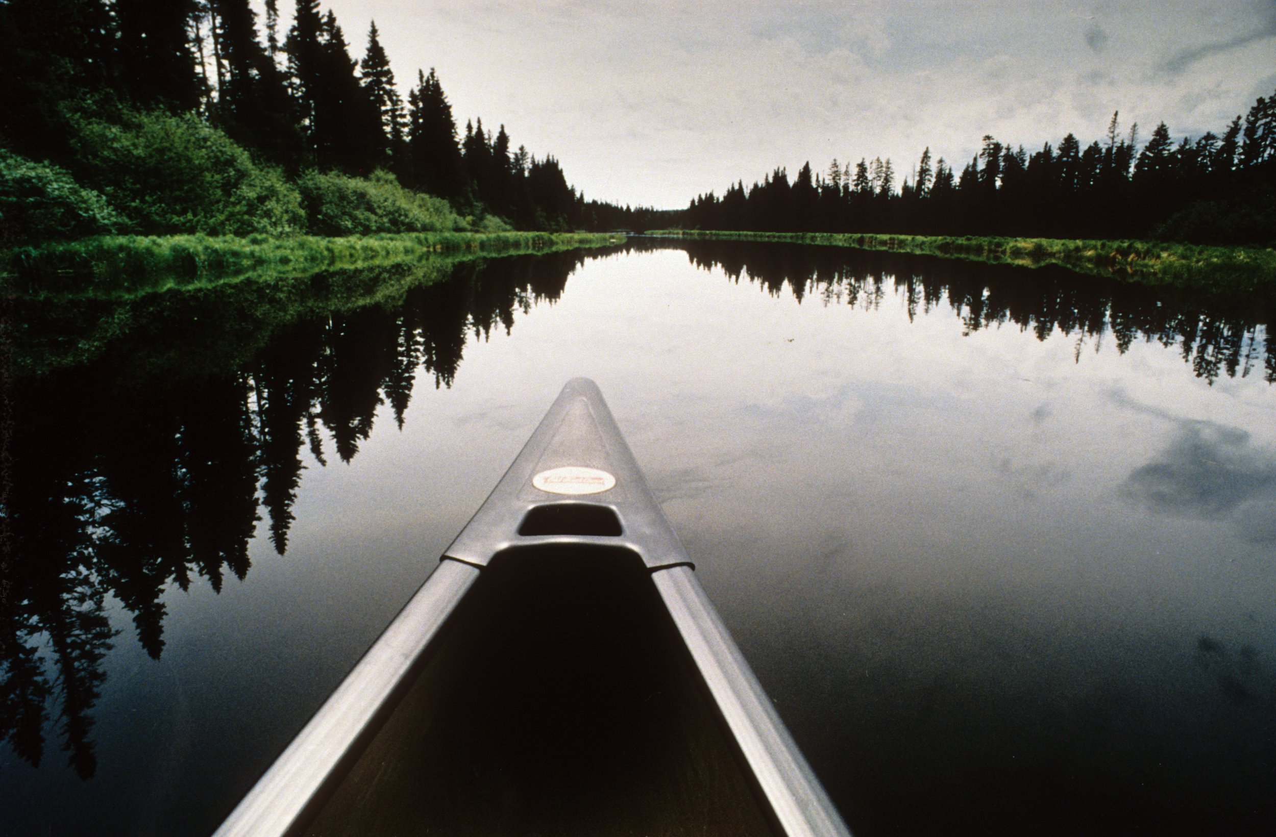
Canoeing the Connecticut in its northern reaches, the shore lined with spruce and fir, the water often calm in the early morning hours, is a peaceful experience. Click to enlarge.
Coming upon a dam and a portage, if the terrain permitted I would get out my little axle and wheels and work my way around.
I brought along too much stuff. Made the portages I had to do on foot that much more tiring and time consuming.
The Connecticut River as it flows between Vermont and New Hampshire is actually all in New Hampshire. But Hartland Rapids, or Sumner Falls, a big slab of ledge that produces tricky whitewater, is nonetheless associated with Vermont.
The impoundment upstream of a dam at Littleton, N. H. There are 16 dams on the Connecticut, most of them creating an upriver impoundment. Click to enlarge.
Finishing the voyage in Old Saybrook, CT, I was reunited with my family; my wife, Susan, daughter, Allison, and, on my shoulder, my son, Scott.